
European primary forests
La Lettura - Corriere della Sera
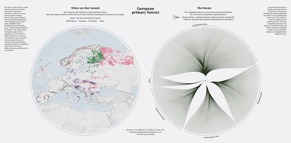
The visualization displays over 18,000 patches of European primary forests. The data is derived from a study published in the academic journal 'Scientific Data.' To gather information on European primary forests, researchers collected and validated 48 datasets published by public or non-governmental institutions. The result is the most comprehensive dataset on primary forests in Europe, freely accessible and useful for ecological studies and conservation planning to safeguard these unique forests.
On the left side of the visualization, areas of primary forest are depicted on a map and categorized by the most abundant tree species. The right side focuses on the main threat identified for a selection of 253 patches of primary forest. In this study, a patch refers to an area of approximately 1 hectare.
Source: F. M. Sabatini, H. Bluhm, Z. Kun et al. European primary forest database v2.0. Sci Data 8, 220 (2021).
Data analysis by Otho Mantegazza.
Data visualization by Federica Fragapane.
The visualization
Details


The original La Lettura's page

Data analysis by Otho Mantegazza.
Data visualization by Federica Fragapane.


